Size of this preview: 800 × 567 pixels. Other resolution: 1,024 × 726 pixels.
Original file (1,024 × 726 pixels, file size: 390 KB, MIME type: image/png)
Summary
Summary
| Description | |
|---|---|
| Source |
|
| Date |
2005-09-05 |
| Author | |
| Permission (Reusing this file) |
See below. |
| Other versions | Template:DerivativeVersions |
Template:Assessments Template:QualityImage {{Convert to SVG|ma
Licensing
I, the copyright holder of this work, hereby publish it under the following licenses:
You may select the license of your choice.
|


File history
Click on a date/time to view the file as it appeared at that time.
| Date/Time | Thumbnail | Dimensions | User | Comment | |
|---|---|---|---|---|---|
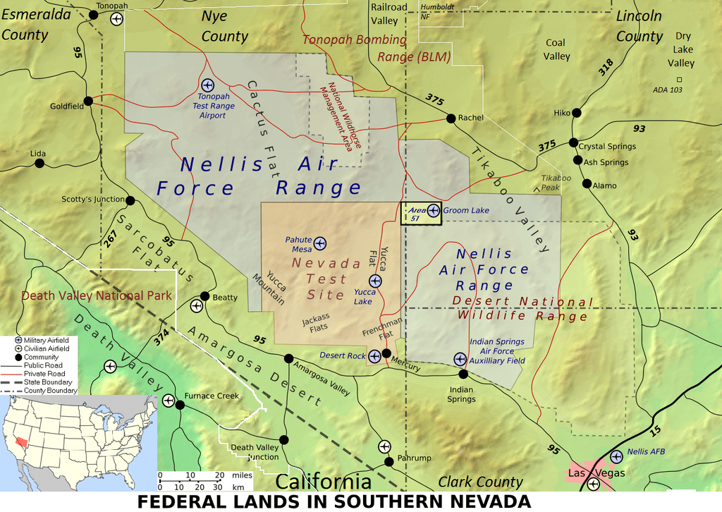
| current | 18:19, 24 January 2024 | | 1,024 × 726 (390 KB) | Isidore (talk | contribs) | == {{int:filedesc}} == {{Information |Description = {{Multilingual description |en= Map of federal lands in southern Nevada, including: * Nellis Air Force Base * Area 51 * Tonopah Test Range * Yucca Mountain * Mercury * Nevada Test Site * Nellis Air Force Range * [[:en:Desert National Wildlife Range|Desert N... |
You cannot overwrite this file.
File usage
The following 3 pages use this file: