Size of this preview: 800 × 400 pixels. Other resolution: 1,024 × 512 pixels.
Original file (1,024 × 512 pixels, file size: 722 KB, MIME type: image/png)
Summary
Summary
| Description |
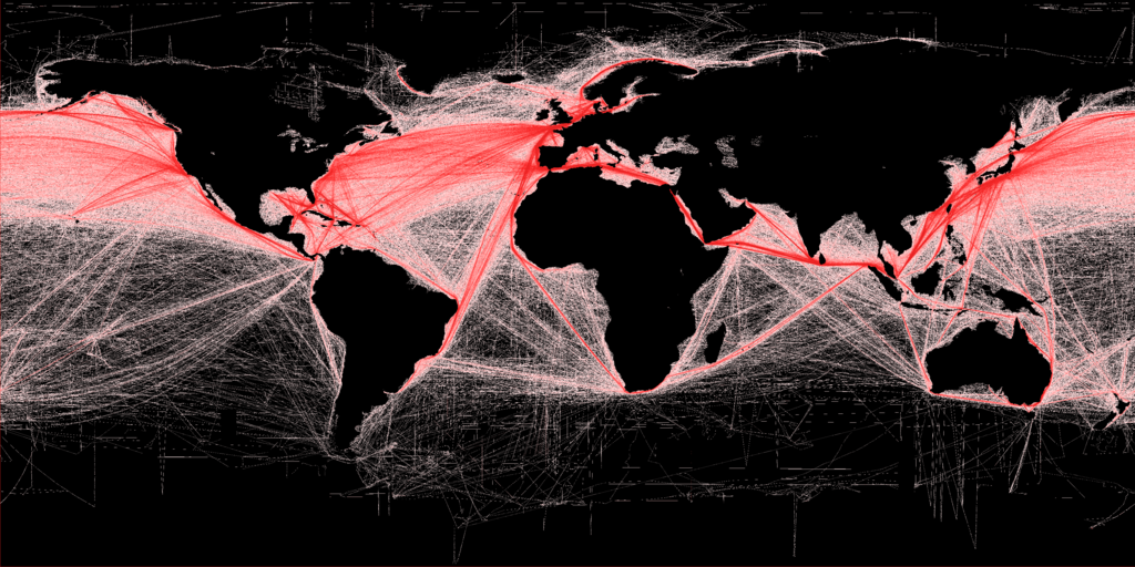
English: Shipping density (commercial). A Global Map of Human Impacts to Marine Ecosystems, showing relative density (in color) against a black background. Scale: 1 km. |
|---|---|
| Source |
|
| Date |
2012-03-19 |
| Author | |
| Permission (Reusing this file) |
See below. |
| Other versions | Template:Derived from |
Licensing
I, the copyright holder of this work, hereby publish it under the following license:
|
File history
Click on a date/time to view the file as it appeared at that time.
| Date/Time | Thumbnail | Dimensions | User | Comment | |
|---|---|---|---|---|---|
| current | 19:46, 29 January 2024 | | 1,024 × 512 (722 KB) | Isidore (talk | contribs) | {{svg|map}} =={{int:filedesc}}== {{Information |description={{en|1=Shipping density (commercial). A Global Map of Human Impacts to Marine Ecosystems, showing relative density (in color) against a black background. Scale: 1 km.<br /> More details available at: http://spatial-analyst.net/worldmaps/shipping.rdc}} |date=2012-03-19 |source={{own using}} * Work of Tomislav Hengl at: Halpern, B.S., et al. 2008. [http://www.nceas.ucsb.edu/globalmarine/impacts A Global Map of Human... |
You cannot overwrite this file.
File usage
The following 2 pages use this file: