Size of this preview: 596 × 600 pixels. Other resolution: 1,186 × 1,193 pixels.
Original file (1,186 × 1,193 pixels, file size: 327 KB, MIME type: image/jpeg)
Summary
Summary
| Description |
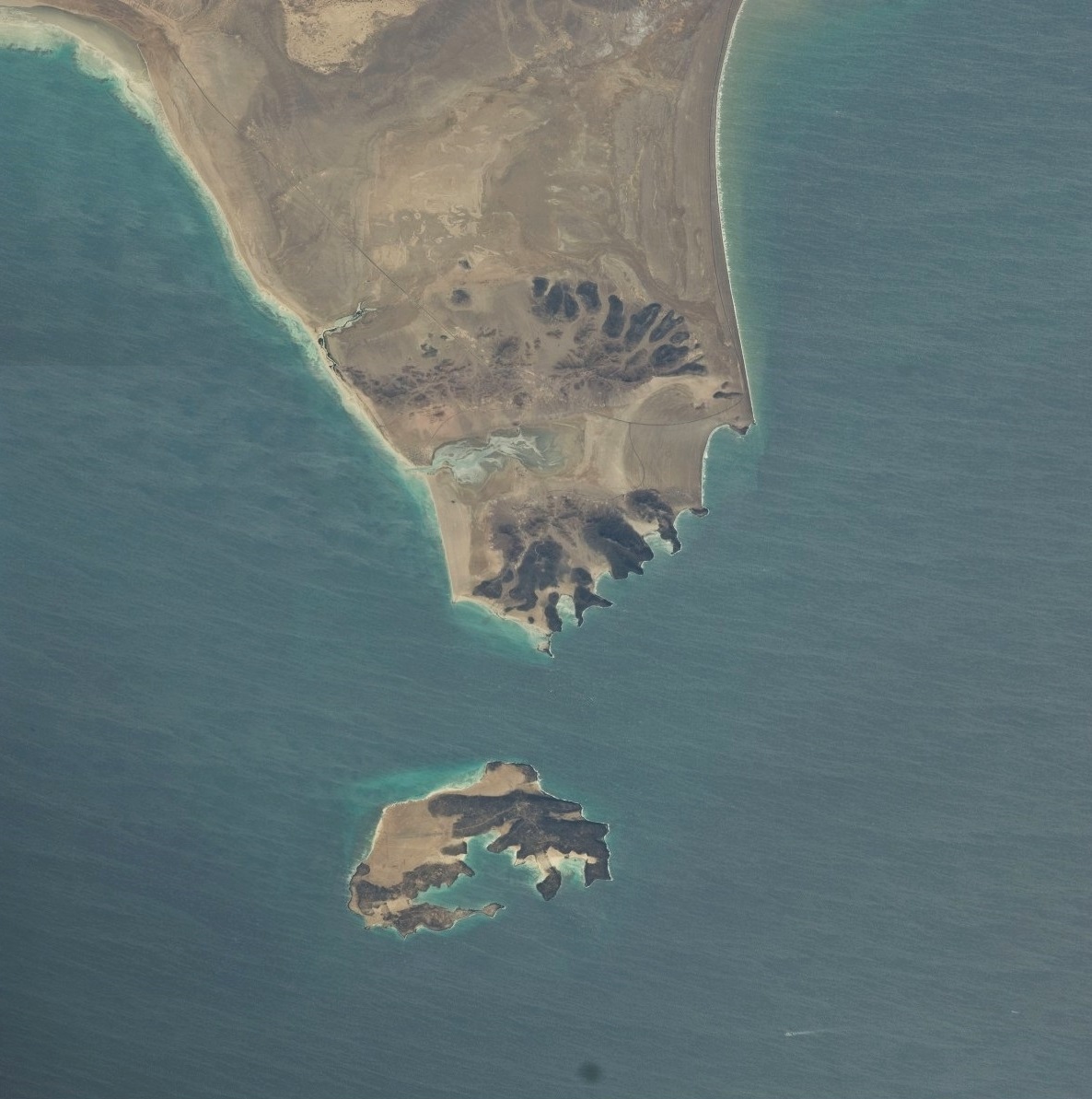
English: Aerial view of part of the Strait of Bab-el-Mandeb showing Perim Island and Ras Menheli, also known as Bab-el-Mandeb Peninsula and Shaikh Said Peninsula. Taken from the International Space Station 13 March 2010 at an altitude of 298 km. This image is made of two separate photos joined together. Template:Fr |
|---|---|
| Source |
ISS Photo Library: http://issphotolibrary.com/en |
| Date |
2010 |
| Author |
NASA |
| Permission (Reusing this file) |
See below.
|
Licensing
| This file is in the public domain, because (no reason given!)
Please verify that the reason given above is valid! Note: if there is a specific licence tag for the reason supplied here, please use it. |
File history
Click on a date/time to view the file as it appeared at that time.
| Date/Time | Thumbnail | Dimensions | User | Comment | |
|---|---|---|---|---|---|
| current | 15:41, 24 December 2023 | | 1,186 × 1,193 (327 KB) | Isidore (talk | contribs) | =={{int:filedesc}}== {{Information |description={{en|1=Aerial view of part of the Strait of Bab-el-Mandeb showing Perim Island and Ras Menheli, also known as Bab-el-Mandeb Peninsula and Shaikh Said Peninsula. Taken from the International Space Station 13 March 2010 at an altitude of 298 km. This image is made of two separate photos joined together.}} {{fr|1=Vue aérienne d'une section du détroit de Bab-el-Mandeb montrant l'île de Périm et Ras Menheli, également connu sous le nom de péninsule... |
You cannot overwrite this file.
File usage
The following page uses this file: