Size of this PNG preview of this SVG file: 659 × 600 pixels. Other resolution: 2,251 × 2,048 pixels.
Original file (SVG file, nominally 709 × 645 pixels, file size: 217 KB)
Summary
Summary
| Description |
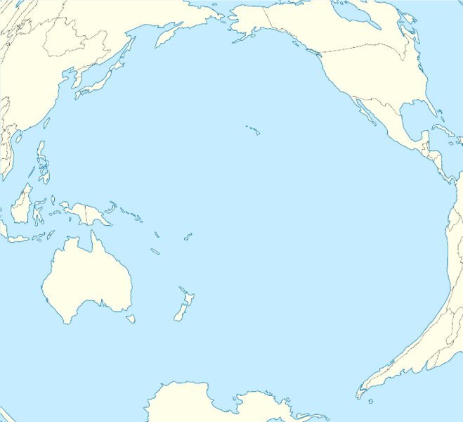
English: Location map of Pacific Ocean. * Projection: Lambert azimuthal equal-area projection. * Area of interest: :* N: 60.0° N :* S: -80.0° N :* W: -260.0° E :* E: -70.0° E * Projection center: :* NS: -10.0° N :* WE: -165.0° E * GMT projection: -JA-165.0/-10.0/180/19.998266666666666c * GMT region: -R-320.2519138145009/-12.459450078533589/-5.473602099069988/26.40516525873812r * Land and shoreline: 1:110m Natural Earth Datasets, borders 1:50m |
|---|---|
| Source |
Own work |
| Date |
2012-02-01 |
| Author | |
| Permission (Reusing this file) |
See below.
|
Shell script for generating the map using GMT Archived (Date missing) at gmt.soest.hawaii.edu (Error: unknown archive URL)
#!/bin/sh

# Set common options
PROJECTION=A-165.0/-10.0/180/19.998266666666666c
REGION=-320.2519138145009/-12.459450078533589/-5.473602099069988/26.40516525873812r
FILENAME=Pacific_Ocean_laea_location_map.ps

# Get Natural Earth datafiles
echo "Downloading datafiles from naturalearthdata.com"
wget -nv -nc \
 http://www.naturalearthdata.com/http//www.naturalearthdata.com/download/110m/physical/110m-coastline.zip\
 http://www.naturalearthdata.com/http//www.naturalearthdata.com/download/110m/physical/110m-land.zip\
 http://www.naturalearthdata.com/http//www.naturalearthdata.com/download/110m/cultural/110m-admin-0-boundary-lines.zip
echo "...done\n"

echo "Inflating archives"
unzip 110m\*.zip
echo "...done\n"

echo "Converting shapefiles to GMT"
ogr2ogr -F GMT 110m_land.gmt 110m_land.shp
ogr2ogr -F GMT 110m_coastline.gmt 110m_coastline.shp
ogr2ogr -F GMT 50m_borders.gmt ne_50m_admin_0_boundary_lines_land.shp
echo "...done\n"

echo "Creating maps"
GMT psxy -m -J$PROJECTION -R$REGION --PAGE_COLOR=198/236/255  --POLAR_CAP=none --PAPER_MEDIA=A3  --BASEMAP_TYPE=plain --BASEMAP_AXES=NESW --FRAME_PEN=0.15p,black 110m_land.gmt -K -G254/254/233 > $FILENAME
GMT psxy -m -J$PROJECTION -R$REGION 110m_coastline.gmt -O -K -W0.535p,9/120/171  >> $FILENAME
GMT psxy -m -J$PROJECTION -R$REGION 50m_borders.gmt -O -W100/100/100  >> $FILENAME
echo "...done\n"

echo "You can now open $FILENAME in Inkscape to clean up the file and save it as SVG. You should add an ocean coloured background and simplify the graticules using CTRL+L."

gv $FILENAME
Licensing
I, the copyright holder of this work, hereby publish it under the following license:
|
File history
Click on a date/time to view the file as it appeared at that time.
| Date/Time | Thumbnail | Dimensions | User | Comment | |
|---|---|---|---|---|---|
| current | 14:31, 17 November 2023 |  | 709 × 645 (217 KB) | Isidore (talk | contribs) | =={{int:filedesc}}== {{Information |description={{en|1=Location map of Pacific Ocean. * Projection: Lambert azimuthal equal-area projection. * Area of interest: :* N: 60.0° N :* S: -80.0° N :* W: -260.0° E :* E: -70.0° E * Projection center: :* NS: -10.0° N :* WE: -165.0° E * GMT projection: -JA-165.0/-10.0/180/19.998266666666666c * GMT region: -R-320.2519138145009/-12.459450078533589/-5.473602099069988/26.40516525873812r * Land and shoreline: 1:110m [http://www.naturalearthdata.com/downloads... |
You cannot overwrite this file.
File usage
The following 2 pages use this file: