
Size of this PNG preview of this SVG file: 550 × 550 pixels. Other resolution: 2,048 × 2,048 pixels.
Original file (SVG file, nominally 550 × 550 pixels, file size: 580 KB)
Summary
Summary
| Description |
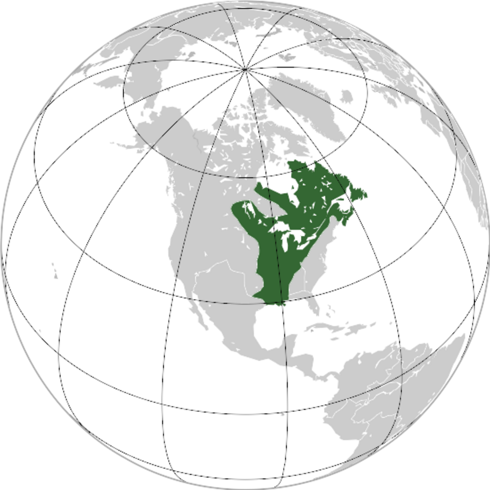
English: New France (orthographic projection) - maximal expansion in 1712 , before Treaty of Utrecht. Template:Fr |
|---|---|
| Source |
Own work |
| Date |
2009-10-18 |
| Author | |
| Permission (Reusing this file) |
See below.
|
Licensing
I, the copyright holder of this work, hereby publish it under the following licenses:
You may select the license of your choice.
|


File history
Click on a date/time to view the file as it appeared at that time.
| Date/Time | Thumbnail | Dimensions | User | Comment | |
|---|---|---|---|---|---|
| current | 15:23, 7 February 2024 | | 550 × 550 (580 KB) | Isidore (talk | contribs) | == {{int:filedesc}} == {{Information |Description={{en|{{W|New France}} (orthographic projection) - maximal expansion in 1712 , before {{W|Treaty of Utrecht}}.}} {{fr|La {{Wf|Nouvelle-France}} dans sa plus grande expansion avant le {{Wf|Traités d'Utrecht (1713)}}.}} |Source={{Own}} |Date=2009-10-18 |Author={{Ut|Martin23230}} |Other fields={{Igen|+|393|s=ggg}} }} == {{int:license-header}} == {{self|cc-by-sa-3.0|GFDL}} [[Category:SVG locator maps of former countries of North America (gray and... |
You cannot overwrite this file.
File usage
The following page uses this file:
.svg&oldid=17783)