Size of this preview: 776 × 600 pixels. Other resolution: 994 × 768 pixels.
Original file (994 × 768 pixels, file size: 715 KB, MIME type: image/png)
Summary
Summary
| Description |
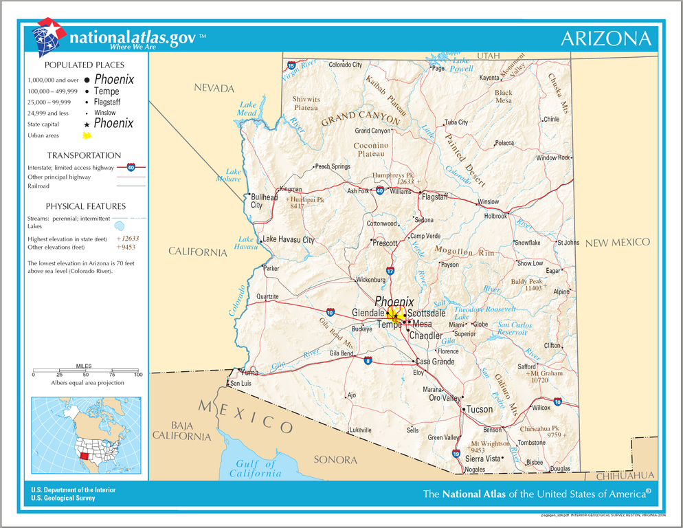
English: Reference Map for the U.S. state of Arizona. |
|---|---|
| Source | |
| Date |
2004 |
| Author | |
| Permission (Reusing this file) |
Public domain
|
Licensing
File history
Click on a date/time to view the file as it appeared at that time.
| Date/Time | Thumbnail | Dimensions | User | Comment | |
|---|---|---|---|---|---|
| current | 18:44, 9 February 2024 | | 994 × 768 (715 KB) | Isidore (talk | contribs) | == {{int:filedesc}} == {{Information | Description = {{en|Reference Map for the {{w|U.S. state}} of {{w|Arizona}}.}} | Date = 2004 | Source = * Website: http://www.nationalatlas.gov/printable/reference.html#Arizona * Map: http://www.nationalatlas.gov/printable/images/pdf/reference/pagegen_az.pdf | Author = {{w|National Atlas of the United States}} | Permission = Public domain | other_versions = }} == {{int:license-header}} == {{PD-USGov-Atlas}} Category:National Atlas maps of Arizona [... |
You cannot overwrite this file.
File usage
The following 3 pages use this file: