Size of this preview: 613 × 599 pixels. Other resolution: 762 × 745 pixels.
Original file (762 × 745 pixels, file size: 769 KB, MIME type: image/png)
Summary
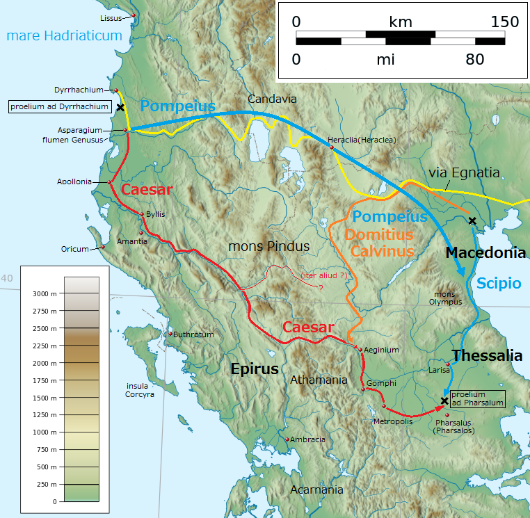
English: Map of Ancient Greece for Caesar's Civil War in 48 BC (by Latin language) 日本語: ローマ内戦(BC48年)における古代ギリシアの地図(ラテン語) Date 15 January 2017 Source Own work + based on File:Greece large topographic basemap.svg Author Linguae Other versions Japanese version, blank version
Licensing
| This work is licensed under the Creative Commons Attribution 4.0 License. |
File history
Click on a date/time to view the file as it appeared at that time.
| Date/Time | Thumbnail | Dimensions | User | Comment | |
|---|---|---|---|---|---|
| current | 08:32, 28 September 2023 | | 762 × 745 (769 KB) | Isidore (talk | contribs) | English: Map of Ancient Greece for Caesar's Civil War in 48 BC (by Latin language) 日本語: ローマ内戦(BC48年)における古代ギリシアの地図(ラテン語) Date 15 January 2017 Source Own work + based on File:Greece large topographic basemap.svg Author Linguae Other versions Japanese version, blank version |
You cannot overwrite this file.
File usage
The following page uses this file:
.png&oldid=3222)