Original file (1,920 × 957 pixels, file size: 669 KB, MIME type: image/png)
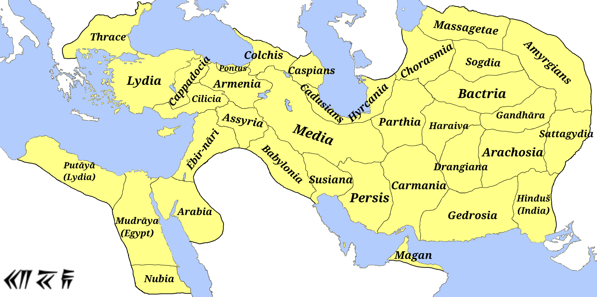
Summary
M.r ebrahim zadeh - Own work persis, carmania, media, colchis, Armenia، Lydia، Cilicia، Cappadocia، haraiva، Drangiana، Caspians، Cadusians، Mudrāya، Babylonia، Putāyā، Bactria، Phenicia، Arachosia، Sogdia، Gedrosia، Assyria، Ebir-nāri، Gandhāra، susiana، Chorasmia، Pontus، Cyclades Islands، Amyrgians and Parthia: Atlas Antiquus. Atlas zur Geschichte des Altertums. Gotha: Justus Perthes, 1909. (File) Hinduš، Arabia، Sattagydia، Babylonia، Arachosia، Chorasmia، Gedrosia، Assyria، Ebir-nāri، Massagetae and Nubia: And Design structure and overview: ACHAEMENID SATRAPIES. ENCYCLOPÆDIA IRANICA. Archived from the original on 26 March 2022. Mudrāya، Gedrosia، Arachosia، Babylonia، Putāyā و Hyrcania: File:Map of the Achaemenid Empire.jpg Thrace and Bahrain:[1] (File) Yehud Medinata: Atlas of the Historical Geography of the Holy Land by George Adam Smith in 1915 (File)
Licensing
| This file is in the public domain, because (no reason given!)
Please verify that the reason given above is valid! Note: if there is a specific licence tag for the reason supplied here, please use it. |
File history
Click on a date/time to view the file as it appeared at that time.
| Date/Time | Thumbnail | Dimensions | User | Comment | |
|---|---|---|---|---|---|
| current | 21:04, 7 November 2023 | | 1,920 × 957 (669 KB) | Isidore (talk | contribs) | M.r ebrahim zadeh - Own work persis, carmania, media, colchis, Armenia، Lydia، Cilicia، Cappadocia، haraiva، Drangiana، Caspians، Cadusians، Mudrāya، Babylonia، Putāyā، Bactria، Phenicia، Arachosia، Sogdia، Gedrosia، Assyria، Ebir-nāri، Gandhāra، susiana، Chorasmia، Pontus، Cyclades Islands، Amyrgians and Parthia: Atlas Antiquus. Atlas zur Geschichte des Altertums. Gotha: Justus Perthes, 1909. (File) Hinduš، Arabia، Sattagydia، Babylonia، Arachosia، Chorasmia، Gedrosia، Assyria، Ebir-nāri، Ma... |
You cannot overwrite this file.
File usage
The following 2 pages use this file:
.png&oldid=7096)