Size of this preview: 800 × 553 pixels. Other resolution: 1,895 × 1,309 pixels.
Original file (1,895 × 1,309 pixels, file size: 461 KB, MIME type: image/png)
Summary
Summary
| Description |
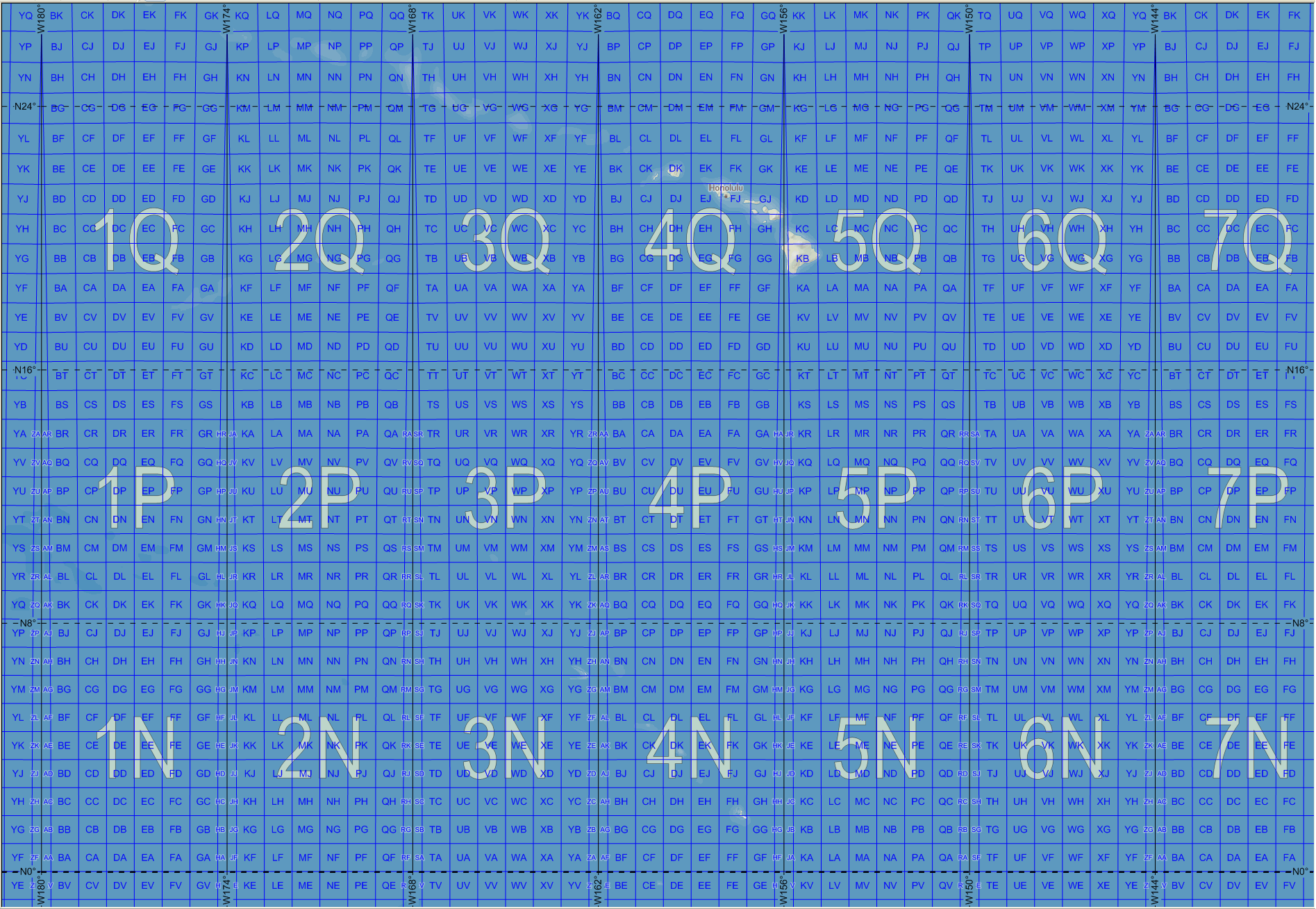
English: Map of the Military Grid Reference System (MGRS) around its origin in the Pacific, with the AA lettering scheme for the 100 km squares. This scheme is used for WGS 84 and some other modern geodetic datums, while the alternative AL lettering scheme is used for some older geodetic datums. |
|---|---|
| Source |
English: Mikael R made the MGRS grid in Carmenta Engine, with a background map from Natural Earth by Tom Patterson, US National Park Service. |
| Date |
2007-11-20 |
| Author |
Mikael Rittri (MikaelR) |
| Permission (Reusing this file) |
See below.
|
Licensing
| This work is licensed under the Creative Commons Attribution-ShareAlike 3.0 License. |
File history
Click on a date/time to view the file as it appeared at that time.
| Date/Time | Thumbnail | Dimensions | User | Comment | |
|---|---|---|---|---|---|
| current | 15:36, 22 January 2024 | | 1,895 × 1,309 (461 KB) | Isidore (talk | contribs) | == {{int:filedesc}} == {{Information |Description= {{en|1=Map of the Military Grid Reference System (MGRS) around its origin in the Pacific, with the AA lettering scheme for the 100 km squares. This scheme is used for WGS 84 and some other modern geodetic datums, while the alternative AL lettering scheme is used for some older geodetic datums.}} |Source= {{en|Mikael R made the MGRS grid in Carmenta Engine, with a background map from Natural Earth by Tom Patterson, US National Park Service.}}... |
You cannot overwrite this file.
File usage
The following page uses this file: