Original file (991 × 634 pixels, file size: 122 KB, MIME type: image/png)
Summary
| Description |
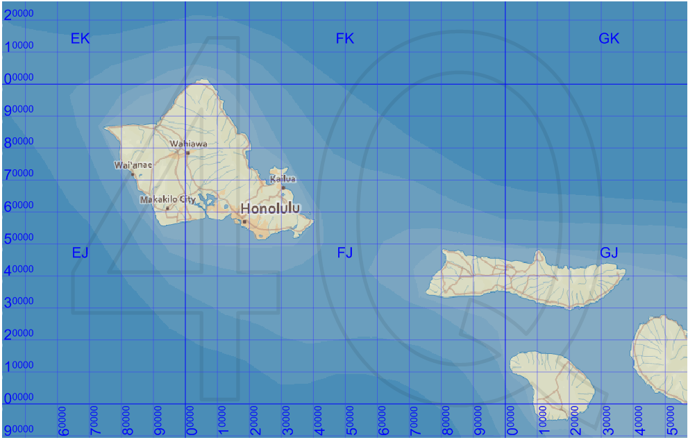
English: Map of the Military Grid Reference System (MGRS) around Hawaii, with the AA lettering scheme for the 100 km squares. This scheme is used for WGS 84 and some other modern geodetic datums, while the alternative AL lettering scheme is used for some older geodetic datums. | ||
|---|---|---|---|
| Source |
Improved version of File:MGRSgridHawaiiSchemeAA.png. The numeric labels for the vertical lines have been better aligned. Mikael R made the MGRS grid in Carmenta Engine, with a background map from Natural Earth by Tom Patterson, US National Park Service, and city names from geonames.org. | ||
| Date |
2010-09-25 | ||
| Author |
Mikael Rittri | ||
| Permission (Reusing this file) |
| ||
| Other versions |
File history
Click on a date/time to view the file as it appeared at that time.
| Date/Time | Thumbnail | Dimensions | User | Comment | |
|---|---|---|---|---|---|
| current | 15:42, 22 January 2024 | | 991 × 634 (122 KB) | Isidore (talk | contribs) | {{Information |Description={{en|1=Map of the Military Grid Reference System (MGRS) around Hawaii, with the AA lettering scheme for the 100 km squares. This scheme is used for WGS 84 and some other modern geodetic datums, while the alternative AL lettering scheme is used for some older geodetic datums.}} |Source=Improved version of File:MGRSgridHawaiiSchemeAA.png. The numeric labels for the vertical lines have been better aligned. Mikael R made the MGRS grid in Carmenta Engine, with a bac... |
You cannot overwrite this file.
File usage
The following page uses this file: