Size of this preview: 800 × 550 pixels. Other resolution: 1,280 × 880 pixels.
Original file (1,280 × 880 pixels, file size: 255 KB, MIME type: image/jpeg)
Summary
| Description |
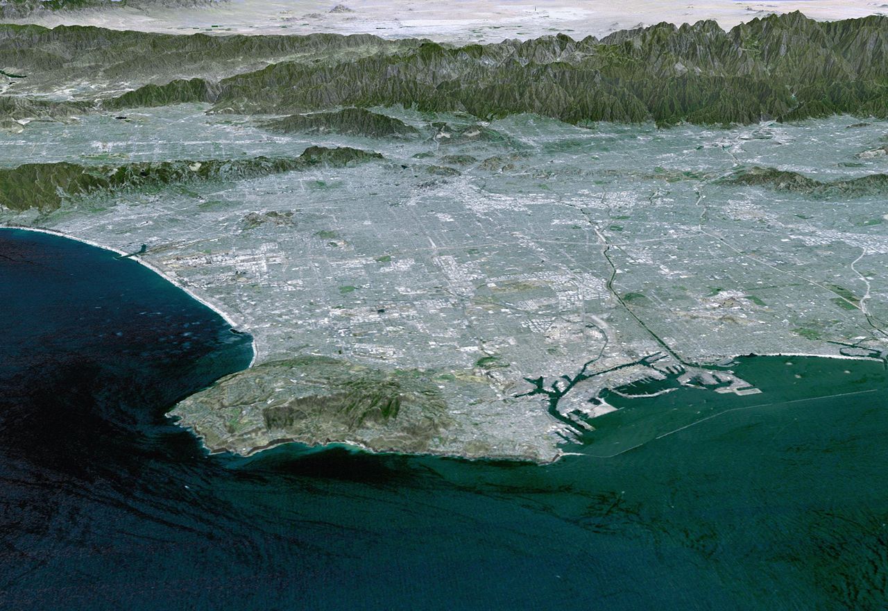
3-D Perspective image of the Los Angeles Basin from the Landsat satellite using NASA's Shuttle Radar Topography Mission (SRTM) for topography information. The vertical scale is exaggerated one and half times. |
|---|---|
| Source | |
| Date |
2000-02 |
| Author |
NASA/JPL/NIMA |
| Permission (Reusing this file) |
|
File history
Click on a date/time to view the file as it appeared at that time.
| Date/Time | Thumbnail | Dimensions | User | Comment | |
|---|---|---|---|---|---|
| current | 16:57, 9 March 2024 | | 1,280 × 880 (255 KB) | Isidore (talk | contribs) | {{Information |Description=3-D Perspective image of the Los Angeles Basin from the Landsat satellite using NASA's Shuttle Radar Topography Mission (SRTM) for topography information. The vertical scale is exaggerated one and half times. |Source=http://photojournal.jpl.nasa.gov/catalog/PIA03348 |Date=2000-02 |Author=NASA/JPL/NIMA<br>{{PD-USGov-NASA-SRTM}} |Permission={{PD-USGov-NASA}} }} 04 04 [[Category:San Gabrie... |
You cannot overwrite this file.
File usage
The following 2 pages use this file: