No higher resolution available.
Inland_navigation_system.png (500 × 541 pixels, file size: 250 KB, MIME type: image/png)
Summary
Summary
| Description |
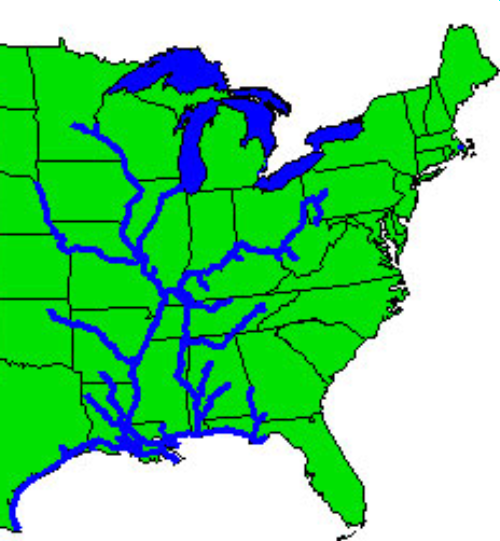
English: Clip of graphic taken from Corps of Engineers website, http://www.tec.army.mil/echarts/inlandnav/, showing the US inland navigational system. Trimmed, enlarged, and smoothed to remove artifacts with the GIMP. | ||
|---|---|---|---|
| Source | |||
| Date | |||
| Author |
| ||
| Permission (Reusing this file) |
See below.
|
| This map image was uploaded in a raster graphics format such as PNG, GIF, or JPEG. However, it contains information that could be stored more efficiently and/or accurately in the SVG format, as a vector graphic. If possible, please upload an SVG version of this image. After confirming it is of comparable quality, please replace all instances of the previous version throughout OODA WIKI (noted under the "File links" header), tag the old version with {{Vector version available|NewImage.svg}}, and remove this tag. For more information, see OODA WIKI:Preparing images for upload. For assistance with converting to SVG, please see the Graphics Lab.Do not re-draw or auto-trace non-free images; instead, seek out vector versions from official sources. |  |
Licensing
| This file is in the public domain, because (no reason given!)
Please verify that the reason given above is valid! Note: if there is a specific licence tag for the reason supplied here, please use it. |
File history
Click on a date/time to view the file as it appeared at that time.
| Date/Time | Thumbnail | Dimensions | User | Comment | |
|---|---|---|---|---|---|
| current | 01:07, 3 December 2023 | | 500 × 541 (250 KB) | Isidore (talk | contribs) | == {{int:filedesc}} == {{Information |Description = {{en|1=Clip of graphic taken from Corps of Engineers website, http://www.tec.army.mil/echarts/inlandnav/, showing the US inland navigational system. Trimmed, enlarged, and smoothed to remove artifacts with the GIMP.}} |Date = |Source = {{own work by original uploader}} |Author = |Permission = |Other_versions = }} {{Convert to SVG|map}} |
You cannot overwrite this file.
File usage
The following page uses this file: