Size of this PNG preview of this SVG file: 700 × 512 pixels. Other resolution: 2,560 × 1,872 pixels.
Original file (SVG file, nominally 700 × 512 pixels, file size: 384 KB)
Summary
Summary
| Description |
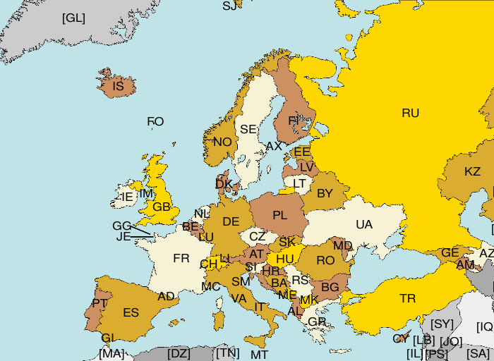
Map of Europe, with ISO 3166-1 Template:Wp · en country and territory codes. SVG format. Map legend in Portuguese and English, with name of sovereign state given in parenthesis, where applicable:
Non-European countries and territories featured in map:
|
|---|---|
| Source |
Own work |
| Date |
2006-06-01 |
| Author | |
| Permission (Reusing this file) |
See below.
|
Licensing
| This work is licensed under the Creative Commons Attribution-ShareAlike 3.0 License. |
File history
Click on a date/time to view the file as it appeared at that time.
| Date/Time | Thumbnail | Dimensions | User | Comment | |
|---|---|---|---|---|---|
| current | 15:23, 23 January 2024 |  | 700 × 512 (384 KB) | Isidore (talk | contribs) | == {{int:filedesc}} == {{Information |Description=Map of Europe, with ISO 3166-1 <sup>{{Wp|ISO 3166-1|pt}} · {{W|ISO 3166-1|en}}</sup> country and territory codes. SVG format. Map legend in Portuguese and English, with name of sovereign state given in parenthesis, where applicable: * '''AD''': Andorra <sup>{{Wp|Andorra|pt}} · {{W|Andorra|en}} · {{C|Andorra|commons}}</sup> * '''AL''': Albânia · Albania <sup>{{Wp|Albânia|pt}} · {{W|Albania|en}} · {{C|Albania|commons}}</sup> * '''AM''': Arménia... |
You cannot overwrite this file.
File usage
The following page uses this file: