Size of this preview: 417 × 599 pixels. Other resolution: 501 × 720 pixels.
Original file (501 × 720 pixels, file size: 71 KB, MIME type: image/jpeg)
Summary
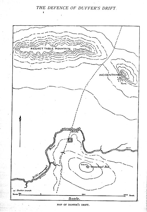
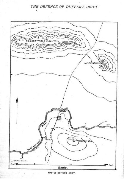
Sir Ernest Dunlop Swinton - Major General Sir Ernest Dunlop Swinton (April 1905). "The Defence of Duffer's Drift". Journal of the United States Infantry Association 1: 140. Map of Duffer's Drift with humorous placenames. The Drift is a choke point, the only crossing of the Silliaasvogel River. The defences are on the slopes of Waschout Hill to the south. Across the river to the north are Regret Table Mountain and the hillside farm of Incidentamba.
Licensing
| This file is in the public domain, because (no reason given!)
Please verify that the reason given above is valid! Note: if there is a specific licence tag for the reason supplied here, please use it. |
File history
Click on a date/time to view the file as it appeared at that time.
| Date/Time | Thumbnail | Dimensions | User | Comment | |
|---|---|---|---|---|---|
| current | 21:38, 13 September 2023 | | 501 × 720 (71 KB) | Isidore (talk | contribs) | Sir Ernest Dunlop Swinton - Major General Sir Ernest Dunlop Swinton (April 1905). "The Defence of Duffer's Drift". Journal of the United States Infantry Association 1: 140. Map of Duffer's Drift with humorous placenames. The Drift is a choke point, the only crossing of the Silliaasvogel River. The defences are on the slopes of Waschout Hill to the south. Across the river to the north are Regret Table Mountain and the hillside farm of Incidentamba. |
You cannot overwrite this file.
File usage
The following page uses this file: