Size of this preview: 645 × 599 pixels. Other resolution: 759 × 705 pixels.
Original file (759 × 705 pixels, file size: 318 KB, MIME type: image/jpeg)
Summary
Summary
| Description |
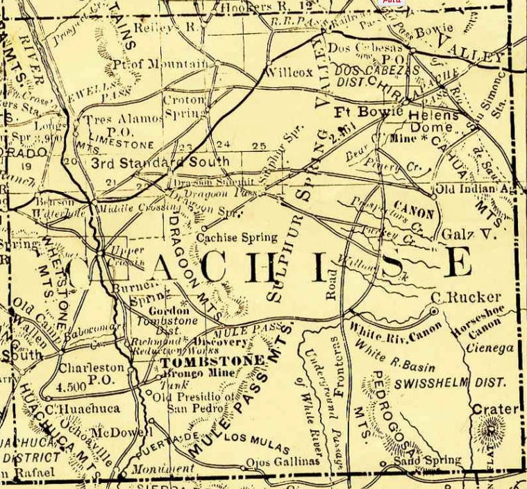
English: Arizona, 1881, map showing roads, railroads, towns, mines, mountains and rivers. Enlarged and cropped Cochise County portion of map. |
|---|---|
| Source |
http://azmemory.azlibrary.gov/cdm/singleitem/collection/shmmaps/id/126 |
| Date |
1881 |
| Author |
Rand, McNally and Company |
| Permission (Reusing this file) |
See below.
|
Licensing
File history
Click on a date/time to view the file as it appeared at that time.
| Date/Time | Thumbnail | Dimensions | User | Comment | |
|---|---|---|---|---|---|
| current | 17:31, 9 March 2024 | | 759 × 705 (318 KB) | Isidore (talk | contribs) | =={{int:filedesc}}== {{Information |description={{en|1=Arizona, 1881, map showing roads, railroads, towns, mines, mountains and rivers. Enlarged and cropped Cochise County portion of map.}} |date=1881 |source=http://azmemory.azlibrary.gov/cdm/singleitem/collection/shmmaps/id/126 |author=Rand, McNally and Company |permission= |other versions= }} =={{int:license-header}}== {{PD-US}} Category:1881 in Arizona Category:Old maps of Arizona Category:Wild West [[Category:Maps of Cochise... |
You cannot overwrite this file.
File usage
The following 3 pages use this file: